
Broad River Sections and Maps
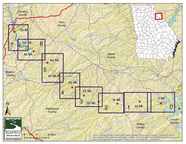
Below are a series of maps related to the Broad River Water Trail. The first map gives an overview of the detailed maps provided below. You can download an Adobe Acrobat bundle with all of the maps at this link. Scroll down to see down-sized versions of these maps in the appropriate sections.
Most of the Broad River Watershed occurs 11 Georgia counties. We have divided up the watershed into three sections, the lower, middle and upper section.
Lower Section – Map 0
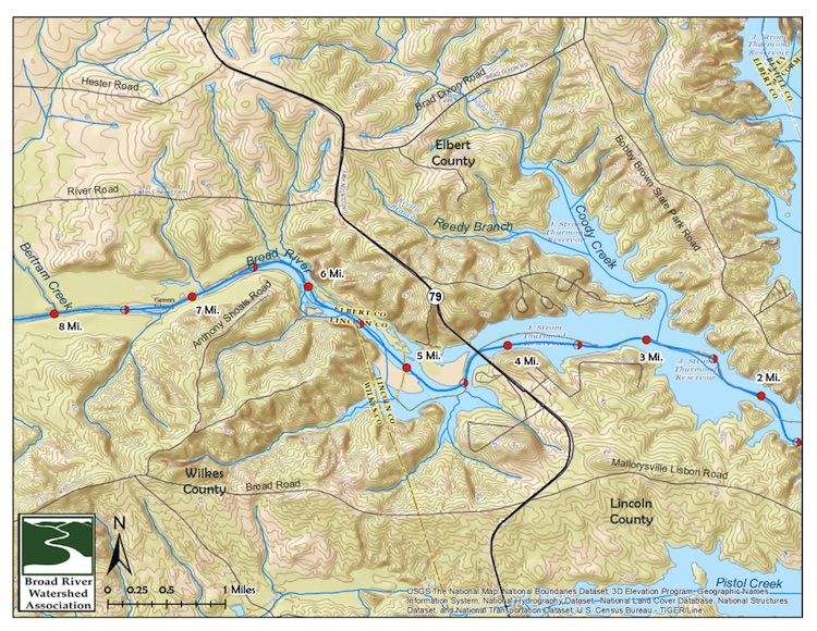
The lower section of the Broad River watershed includes the area from the South Fork of the Broad River downstream and into Clark’s Hill Reservoir (Thurmond Reservoir). It occurs in a portion of Elbert, Oglethorpe, Wilkes and Lincoln Counties. This section includes Maps 0-4 in the above overview. Map 0 - River Mile 1.5 - 8 - Clark's Hill Reservoir upstream to approximately Bertram Creek, including Anthony Shoals.
Click the button to download to your computer or device.

Lower Section – Map 1
River Mile 8 - 13.5 - Bertram Creek upstream to State Route 17.
Click the button to download to your computer or device.
Lower Section – Map 2
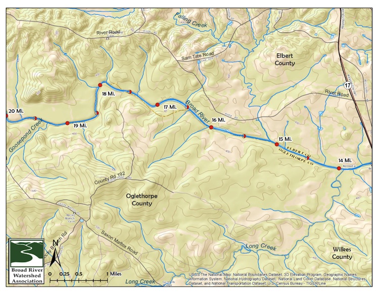
Map 2 - River Mile 14 - 20 - State Route 17 upstream to past Goosepond Creek.
Click the button to download to your computer or device.
Lower Section – Map 3
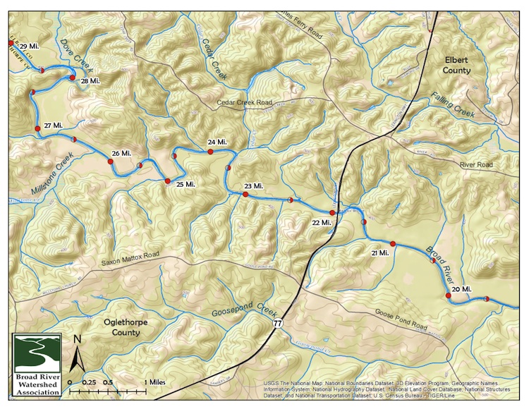
Map 3 - River Mile 19.5 - 29 - Goosepond Creek upstream to past Millstone Creek including the section with State Route 77.
Click the button to download to your computer or device.
Lower Section – Map 4
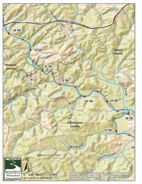
Map 4 - River Mile 26.5 - 34 - Millstone Creek upstream to State Route 72.
Click the button to download to your computer or device.

Middle Section – Map 5
The middle section of the Broad River watershed includes the area downstream from the confluence of the Hudson and Broad Rivers downstream to and including the South Fork of the Broad River. It occurs in a small portion of Hart, Elbert, Clarke, and Oglethorpe Counties, and most of Madison County. This section includes Maps 5-7 in the above overview.
Map 5 - River Mile 34 - 42.5 - State Route 72 upstream to Mill Shoal Creek.
Click the button to download to your computer or device.

Middle Section – Map 6
Map 6 - River Mile 41.5 - 51.5 - Mill Shoal Creek upstream to just downstream of Fowler Branch including State Route 172 and State Route 281 crossings.
Click the button to download to your computer or device.
Middle Section – Map 7
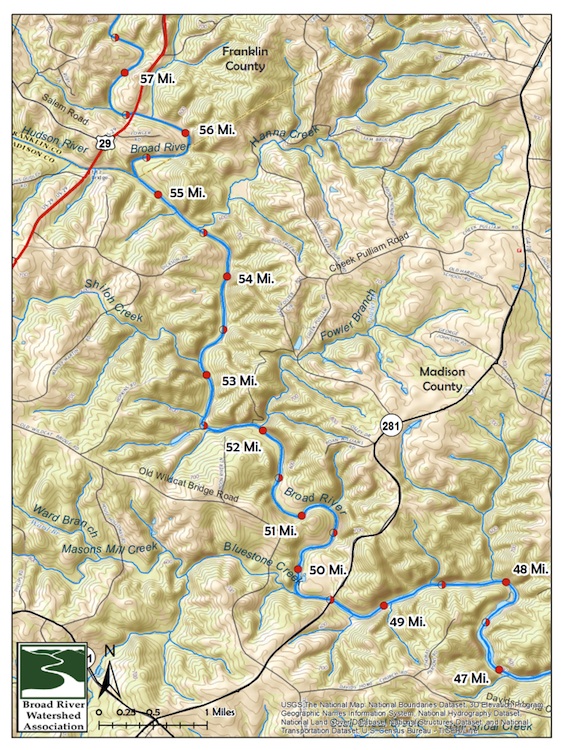
Map 7 - River Mile 47 - 57.5 - Downstream of State Route 281 upstream to U.S. Highway 29 including the Hudson River confluence.
Click the button to download to your computer or device.
Upper Section
The upper section of the Broad River watershed includes the area upstream of the junction of the Hudson River and the Broad River. It occurs in a small portion of Habersham, Jackson, and Hart Counties, almost half of Stephens County, most of Franklin County and all of Banks County. This section of the watershed is typically not paddled and is not currently included in the Broad River Water Trail.
Go to Upper Section Page